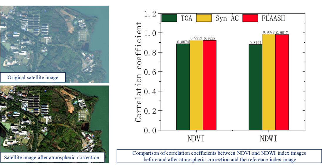
Recently, a research group led by Prof. CUI Wenyu from the Hefei Institutes of Physical Science of the Chinese Academy of Sciences, conducted a 'satellite-UAV' synchronous imaging experiment to investigate the impact of synchronous atmospheric correction on the quantification of remote sensing applications.
The research was published in the IEEE Journal of Selected Topics in Applied Earth Observations and Remote Sensing.
A new atmospheric correction technology for high-resolution satellite images has been developed to address the problem of changing atmospheric conditions that interfere with remote sensing signals. This technology uses on-board equipment to detect atmospheric conditions in real-time. The High Resolution Multi-Mode Integrated Imaging satellite (Gao Fen Duo Mo, GFDM) is equipped with the first commercial Synchronization Monitoring Atmospheric Corrector. However, there has been no previous study to evaluate the impact of this new synchronous atmospheric correction technology on remote sensing applications through representative validation experiments.
“We compared the accuracy of remote sensing data from the GFDM satellite before and after using synchronous atmospheric correction,” said Dr. XU Lingling, a member of the team. The 'satellite-UAV' imaging experiment helped them to see how the correction affected the data’s accuracy.
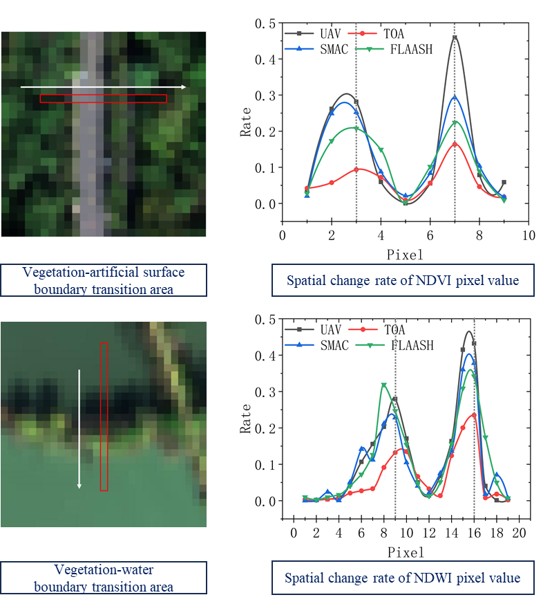
The study highlighted comparisons and analyses of accuracy enhancement effects from different correction methods regarding spatial distribution, numerical accuracy, and transition characteristics of neighboring regions in the remote sensing index image.
Results proved that synchronous atmospheric correction, using SMAC, is more effective than traditional asynchronous methods, especially in areas with low reflectivity and at boundaries between different features.
This results showed that synchronous atmospheric correction is essential for improving the accuracy of applications like water quality monitoring, wetland surveillance, and high-resolution tasks.

Comparison of the visual effects of GFDM satellite images before and after atmospheric correction (left) and the correlation coefficient between the remote sensing index image and the zero-line-of-sight reference index image (right) (Image by XU Lingling)

Comparison of spatial change rates of remote sensing indexes in transitional areas of different land features before and after atmospheric correction. (XU Lingling)