In many Asian regions, especially in China, agricultural fields are typically small, scattered, and lack clear boundaries, which complicates effective crop distribution and agricultural analysis using remote sensing technology.
A novel dual-branch deep learning model (DBL), developed by a research group from the Hefei Institutes of Physical Science of the Chinese Academy of Sciences, addressed this challenge.
“This model is for crop-type mapping of irregular agricultural fields in Asia,” said Associate Prof. XU Taosheng, who led the team, “it tackles the challenge of crop-type mapping in most of Asia's planting plots”.
The results of the research were published in Remote Sensing of Environment.
In this study, the researchers introduced a new deep learning model and time-series datasets. The advanced dual-branch network was developed for mapping crop types in time-series remote sensing images. The model consists of two branches: one that captures large-scale landscape patterns, and another that focuses on fine-grained details, such as subtle changes in crop growth over time. This combination allows the model to recognize crop types accurately, even in complex and disorganized fields.
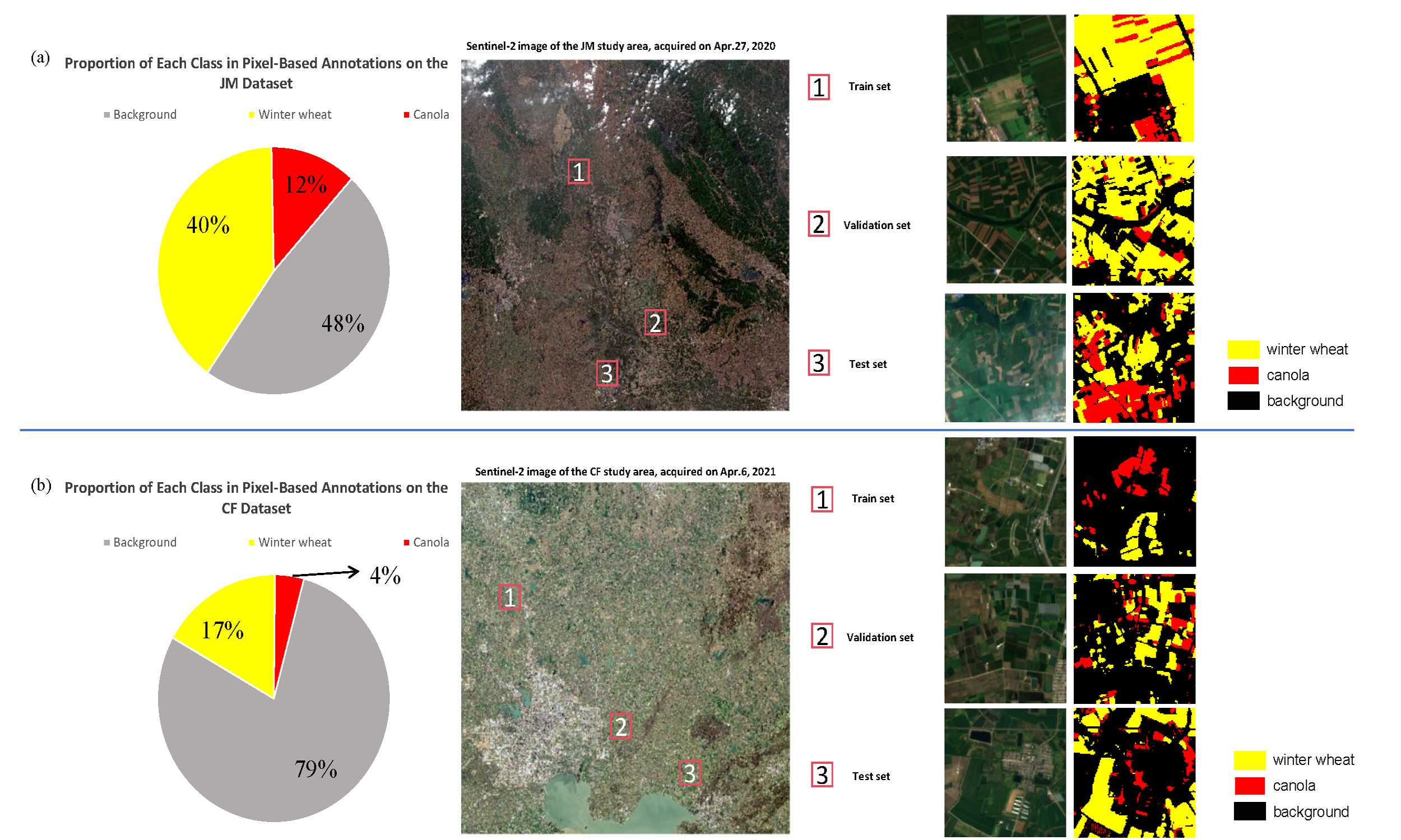
A key feature of this model is its ability to analyze both time and space. Crops grow and change over time, and the model tracks these changes. The researchers created two new datasets (CF and JM) to reflect the characteristics of scattered farmlands, with plots of different sizes and shapes. The model can track crop growth over time, capturing the dynamic nature of agriculture.
Excellent results, with 97.7% overall accuracy and 90.7% accuracy in identifying crop types and small fields, were achieved. These results proved that the model is highly adaptable and accurate for real-world use, especially in regions with fragmented farmland.
“Our finding can facilitate agricultural research in regions with similar planting patterns, particularly in some Asian areas using the time-series remote sensing analysis.” said Associate Prof. XU.

An overview of satellite imagery in the study areas and the visualization of time-series remote sensing datasets. (Image by XU Taosheng)