


A research team led by Prof. LIU Xiao from Hefei Institutes of Physical Science, Chinese Academy of Sciences, have developed methods to improve the reconstruction and transformation of remote sensing images captured at different wavelengths.
The studies address three tasks: adding color to near-infrared images, reconstructing color images from multiple shortwave infrared bands, and converting visible-light images into thermal infrared images.
The findings have been published in Remote Sensing and Applied Optics.
Remote sensing instruments capture images at different wavelengths to reveal information about the Earth's surface. However, near-infrared and shortwave infrared images often lack natural color, while thermal infrared images show temperature patterns rather than object appearance. These differences make the images harder to interpret and simulate.
To add color to near-infrared images, the team developed a method called RWU-DD-GAN. It captures both the overall structure of a scene and fine details, producing clearer images with less color distortion and texture blurring. Tests also showed that the method supports real-time processing.
For shortwave infrared images, the researchers selected three complementary spectral bands based on atmospheric effects and the reflectance of different land surfaces. They then used a deep learning model to combine information from these bands and reconstruct color images, improving image quality compared with methods using a single band.
The team also developed DGC_GAN to convert visible-light images into thermal infrared images without requiring matched image pairs for training. The method preserves the geometric structure of scenes while generating varied thermal infrared images. Tests using public datasets and images collected by a dual-spectrum camera mounted on an unmanned aerial vehicle showed that it could produce realistic images in complex outdoor environments.
The aforementioned research on images across spectral bands provides technical support for infrared remote sensing data expansion, complex scene image simulation, and related algorithm research.
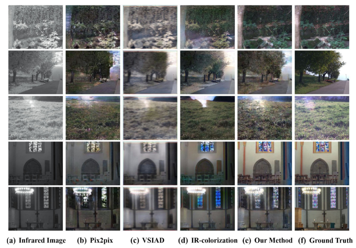
Near infrared image colorization and comparison of results across different methods. (Image by LIU Xiao)